
September 9, 16, 23, and 30, 2020
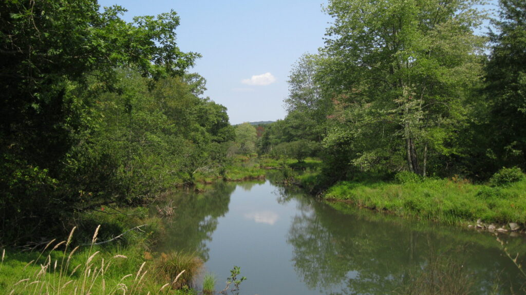
Protecting a healthy vegetated buffer area around streams is an important step to protect the overall health and water quality of the stream itself. However, buffer protection can be challenging to implement. In this online webinar series, we discussed the science behind stream buffers, current regulations, and what communities can do to protect streams and buffers. Recordings of each webinar session are below, along with links to stream buffer protection resources.
September 9: The Science of Stream Buffers | Webinar recording
1-2 PM
Dr. Peter Groffman, Environmental Sciences Initiative at CUNY and Brooklyn College
Riparian areas are the interface between land and water and function as “buffer zones” along waterbodies. These areas play a critical role in processing nutrients to improve water quality and protect stream health. Dr. Peter Groffman will describe how these areas function and why they are so unique.
September 16: State Regulations and Resources | Webinar recording | links to resources
1-2 PM
Corbin Gosier, NYS Department of Environmental Conservation, Division of Fish & Wildlife, Bureau of Ecosystem Health
Beth Roessler, NYS Department of Environmental Conservation, Hudson River Estuary Program
Corbin Gosier from NYS DEC will give an overview of New York State’s stream protection program. Beth Roessler will describe existing information, funding sources, and other resources available to better understand and protect local streams and their buffers.
September 23: Stream Buffer Protection in Action | Webinar recording
1-2 PM
Mark Carabetta, Town of New Paltz Wetlands Inspector, Milone & MacBroom
Nava Tabak, Scenic Hudson
Two case studies will share options for stream and buffer protection at a local level. Mark Carabetta, Town of New Paltz Wetlands Inspector, will describe how their local wetland and stream protection law is implemented. Nava Tabak from Scenic Hudson will discuss the role that land trusts play in protecting streams and buffers, with a specific focus on managing buffers along the Catskill Creek at the Mawignack Preserve in the Town of Catskill.
September 30: Local Tools to Protect Streams & Buffers | Webinar recording
1-2 PM
Emily Svenson, Law Office of David K. Gordon
Municipalities can use a variety of different approaches to protect streams and buffers. Emily Svenson, land use attorney, will provide an overview of these opportunities, in addition to stream protection laws, land acquisition, and conservation easements.
Organized by the Hudson River Watershed Alliance and Hudson River Estuary Program. Sponsored by the Hudson River Estuary Program, New York State Department of Environmental Conservation, with support from the New York State Environmental Protection Fund, in cooperation with NEIWPCC.
We’ve also compiled a list of resources that might be helpful for stream and buffer protection. See below!
Wetland and Watercourse Protection Measures
NYS Department of State and NYS Department of Environmental Conservation
New York State Department of State (DOS) prepared a collection of model local laws, in consultation with the New York State Department of Environmental Conservation (NYSDEC) and other stakeholders, that include consideration of future risk due to sea-level rise, storm surge and/or flooding as a result of climate change as required in the New York State Community Risk and Resiliency Act of 2014. Municipal adoption of model local laws is intended to help local governments and their communities increase resiliency.
Conserving Natural Areas & Wildlife in Your Community and Creating a Natural Resources Inventory
Hudson River Estuary Program, NYS Department of Environmental Conservation
The first handbook describes various tools that local governments can be use to conserve natural areas, including streams and their buffers. The second handbook focuses in on the process to create a Natural Resources Inventory, which can be an important tool for municipalities to identify and share information on significant natural resources.
Watershed Design Guide: Best Practices for the Hudson Valley
Orange County Water Authority and Regional Plan Association
This document was created to be a reference during municipal planning processes such as site planning, comprehensive planning, and developing municipal land use regulations to help applicants and local officials communicate about and enhance proposed design elements. It was written for members of local planning boards and commissions, citizen planners, and advocates, as well as responsible developers.
Draft Language for Stream Corridor Overlay Local Law
Moodna Creek Watershed Intermunicipal Council
Orange County Planning Department worked with the Moodna Creek Watershed Intermunicpal Council’s Education & Outreach Committee to develop a model local law for a Stream Corridor Overlay district. This model law was distributed to all 15 municipalities within the Moodna Creek watershed.
Navigable Waters Protection Rule
United States Environmental Protection Agency
On January 23, 2020, the U.S. Environmental Protection Agency and the Department of the Army finalized the Navigable Waters Protection Rule to define “Waters of the United States” and thereby establish federal regulatory authority under the Clean Water Act. The Navigable Waters Protection Rule is the second step in a two-step process to review and revise the definition of “waters of the United States.” This website also includes fact sheets on the rule, a webinar explaining key elements, and a PDF copy of the webinar’s slides. Note that this rule does not protect stream buffers, only the waterways themselves.
Stream Buffer Fact Sheet and Hudson Estuary Trees for Tribs
Hudson River Estuary Program, NYS Department of Environmental Conservation
This fact sheet describe the benefits of healthy stream buffers to protect waterbodies. The Hudson Estuary Trees for Tribs Program helps to protect and restore streamside buffers by providing free native trees and shrubs for qualifying planting projects in the Hudson River estuary watershed.