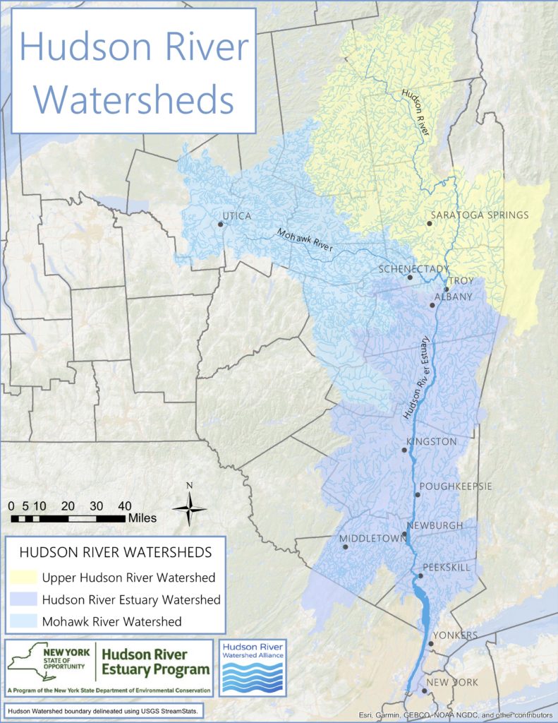
The Hudson River watershed covers almost 13,400 square miles, and includes the Upper Hudson, Mohawk River, and Hudson River estuary watersheds. Water flows from the land into the Hudson River by way of rivers and streams, and underground through groundwater aquifers. Hundreds of tributary streams carry water to the Hudson River, and each of those smaller rivers and streams has its own watershed, too. You can learn more about how watersheds are defined here. Interested in finding your watershed? Check out our detailed PDF watershed maps and directions to use interactive watershed mappers.
The Hudson River watershed is almost entirely in New York State, with small portions in Vermont, Massachusetts, Connecticut, and New Jersey. About 25% of New York State’s land area is included within the Hudson River watershed.
The Hudson River begins at Lake Tear of the Clouds in the Adirondack Mountains, starting as Feldspar Brook and feeding into the Opalescent River, Calamity Brook, and then the Hudson River. The Hudson River flows over 325 miles south to New York City. The Mohawk River flows 149 miles east, and joins the Hudson River at Cohoes, just north of Albany.The 153-mile section from Troy to New York Harbor is a tidal estuary.
The Hudson River watershed includes the traditional land of indigenous people, including the Munsee Lenape, Wappinger, Mohican, Haudenosaunee, Oneida, and Mohawk, who have stewarded this land throughout the generations. The Mahican originally called the river the Muh-he-kun-ne-tuk, which means “great waters in constant motion” or, more loosely, “river that flows two ways”.
The Hudson River Watershed Alliance works with local watershed partners throughout the Hudson River watershed. These include community-based volunteer groups, inter-municipal councils, initiatives of agencies and organizations, and local advocates.


